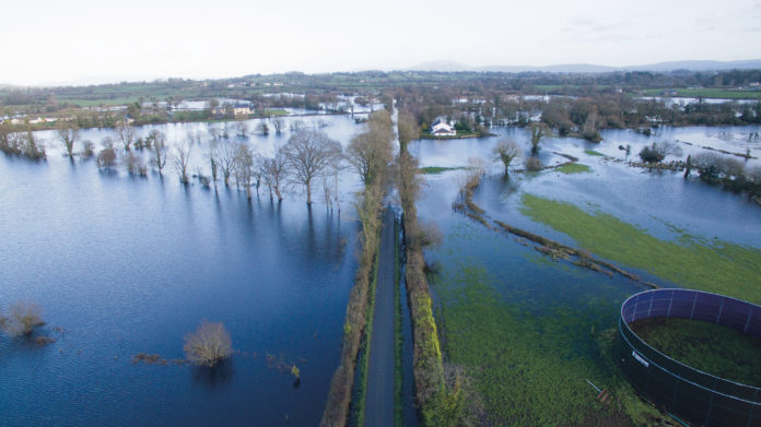
Staff with Limerick City and County Council will continue their round-the –clock monitoring of water levels along the River Shannon catchment area as the threat of flooding continues.
Lands are already under water in Montpelier, Castleconnell, Annacotty, and the Mountshannon area of Lisnagry with forecasters predicting higher water levels in the next few days.
Eleven pumps, a boom and sandbags have been deployed to the areas most at risk of flooding, with Defence Force personnel supporting the work of staff from Limerick City and County Council and the Civil Defence.
Protective walls using sandbags have been built at some of the most vulnerable locations liable to flooding.
The road in Castleconnell from near Charco’s down to World’s End and Castleconnell Boat Club is closed, while motorists are advised to exercise extreme caution when driving on roads that are partially flooded.
The cycleway/ walkway from Irish Estates, through to the Guinness Bridge and on to UL is closed until further notice.
It’s expected that water levels will increase along the Shannon as more water is released from Parteen Weir in the next few days.
There are no indications that other areas of Limerick prone to flooding will be affected at this time.
Limerick City and County Council is in regular contact with the HSE and An Garda Síochána to keep them updated of the situation.


